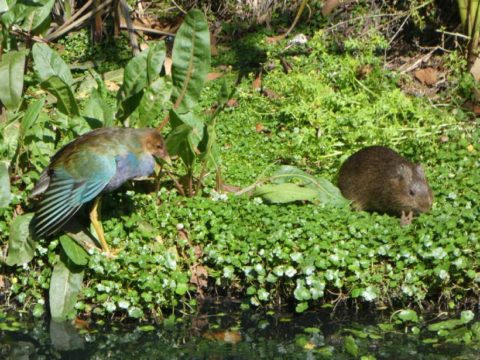
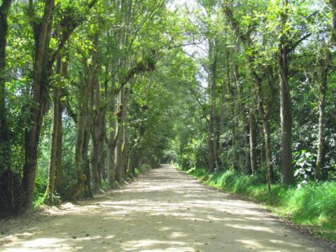
The wetlands of Bogotá—humedales in Spanish—are one of the most important and biodiverse ecosystems in Colombia’s sprawling capital city. They are the backbone of many conservation efforts as they contribute to the improvement of water and air quality, mitigate floods, and provide habitat to endemic and migratory species.

The wetlands are the product not only of the ecological conditions of the area but also of the construction and later deactivation of a complex hydraulic system established by Indigenous groups that populated the territory in the pre-Columbian period, as explained in a paper published in SPAL-Revista de Prehistoria y Arqueología by Lorena Rodríguez Gallo, a history professor and researcher at Universidad Nacional de Colombia. Rodríguez’s work describes how humans have transformed this landscape over thousands of years.
Today several parts of the Bogotá region, which occupies a high-altitude plateau (averaging 2,550 meters) in the Colombian Andes known as the Bogotá savanna, are flooded during the rainy season every year. The region’s clay soil has low permeability, and the floods routinely damage roads, homes, and businesses.
Five hundred years ago, however, the city looked very different. Although the region surrounding Bogotá was, according to Rodríguez, “a highly floodable plain with difficult [natural] drainage,” Indigenous groups developed and operated a sophisticated system that used the region’s floods to their advantage.
Who Are the Muisca?
The first humans to arrive in the Bogotá region did so around 12,000 years ago. The domestication of animals such as guinea pigs and construction of hydraulic engineering projects described in Rodríguez’s analysis allowed some groups to settle permanently around 3,000 years ago. Archaeological and historical evidence suggests that the inhabitants of the region were culturally diverse, describing a series of densely populated settlements without a single political unity.
Early European colonialists, who arrived in the Bogotá region in 1537, named these populations Muiscas. It is traditionally believed that the word comes from moxiga in the Chibcha language, which loosely translates to “people that live in the mountain.” However, the linguistic descriptions used by the first Europeans to arrive in the area are problematic; they translate from their own cultural equivalences, which do not respect or reflect the reality of Indigenous groups.
In this article, we refer to the Muiscas as the Indigenous groups that Europeans first encountered in the Colombian Andes, who shared a language that belongs to the Chibcha family and embody a heterogeneous cultural identity.
Channels and Camellones
Ancient Bogotá’s highly complex hydraulic system consisted of channels and camellones developed by the Muisca. Channels were designed as drainage to “control high volumes of water that might come during a flood,” Rodríguez said, and to transport the excess water into mitigation zones, areas that were created to be cultivated and intentionally flooded. The mitigation zones provided a habitat for animals that could be hunted by Indigenous communities.
Camellones were elevated agricultural fields. These land platforms rose approximately 50–70 centimeters from the ground and were 20–50 meters long by 2–5 meters wide. “The Muisca used camellones to cultivate crops such as corn, beans, pumpkins, and potatoes and engineered the camellones to provide suitable moisture to plant roots.”
Rodríguez’s work documenting the engineered landscape of pre-Columbian Bogotá challenges the idea that Indigenous groups lived in equilibrium with nature. In fact, she said, the connection is more of a dialectical, interdependent relationship, where the Indigenous groups and nature were part of a give and take that benefited humans and encouraged biodiversity as they transformed their environment.
The Muisca hydraulic system, for instance, was a response to the constant floods of the region. The system let the Muiscas produce high quantities of food and create mitigation zones with high biodiversity: terrestrial and wetland plants, as well as animals such as white-tailed deer, birds, fish, ducks, and freshwater mollusks. This relationship is not unique and can be found in ancient Indigenous systems around the world. The Ma’dan people, for example, made elevated platforms for cultivation in the southern wetlands of Iraq.
The Hydraulic System’s Disappearance
The Bogotá region’s channels and camellones are hardly mentioned in historical records. Rodríguez thinks that the “deactivation of the hydraulic system was practically immediate,” following the cultural genocide of the Muisca and their loss of access to land. This idea is supported by Carl Langebaek, an anthropologist, archaeologist, and professor at Universidad de Los Andes in Bogotá. Langebaek said that Conquistadors had neither the cultural background nor the interest to understand or care about the Indigenous hydraulic system.
“[Europeans] came from a society that depended on livestock and seasonal crops, like olives and viticulture,” Langebaek said. The Muisca hydraulic system, dependent on floods and multiple crops, was unknown to them. The first Europeans also “had an extractive mentality to get rich fast with gold.”
The Interdisciplinary Method: Aerial Photos and Interpretation
During the second half of the 20th century, Bogotá grew rapidly and chaotically, changing from a city of 700,000 inhabitants in the 1950s to the more than 7 million today. This rapid expansion destroyed many ecosystems and archaeological sites. To overcome this difficulty in studying the region’s geographic past, Rodríguez used aerial photos of Bogotá taken from the 1930s to the 1950s and compared them with archaeological and historical sources.
These photos “give the impression that camellones resemble a chessboard, constructed in different directions,” said Rodríguez. She was able to contextualize, document, and detect the “transformation processes of the same human group through time” thanks to the geographic and historic differences in the color of the soil and vegetation, identifying erosion and human presence from the vestiges of camellones.
Rodríguez complemented aerial photograph analysis with interdisciplinary approaches. She used paleobotany sources to describe “how the ecological space was at that point in time…and what they were cultivating.”
Historical cartography and toponymy (the study of place names and naming) also provided essential resources. For example, Rodríguez found that in Soacha, a municipality in the Bogotá metropolitan area, “there were a lot of words derived from chucua, the Chibcha word meaning lagoon. There is no lagoon in the area, but the word appears so much that it suggests that in the past there was a lagoon or a mitigation zone.”
Langebaek agrees: “The value of water is very significant.” All the sacred sites in the Bogotá area are “related to water, while other Muisca sacred sites from other regions are related to the Sun. They understood the importance of water for their survival. An important lesson for us today.”

The mitigation zones created by the Muiscas to protect their crops from floods became wetlands supporting some of the most diverse ecosystems in the city. However, since the 1940s, Bogotá has lost more than 90% of these wetland areas as the city continues to build new roads and residential areas to keep up with population growth and other challenges.
Developing Bogotá’s humedales has sparked fierce debate in the city. Developers cite the need for increased infrastructure to support the local economy, whereas grassroots movements are working to preserve ecosystem benefits that are the product of a long history of human-influenced landscape change.
—Camilo Garzón (@CamiloAGarzonC) and Santiago Flórez (@rflorezsantiago), Science Writers


