Malaysia Airlines Flight 370 (MH370) disappeared on 8 March 2014 somewhere in the southern Indian Ocean. The tragic loss of all 239 people aboard led to a multinational multiyear search to find and recover the plane. Despite this effort, it remains missing.
As part of that search effort, three survey vessels collected multibeam bathymetry data using hull-mounted sonars. These data were used to create maps of the seafloor that span roughly 88,000 square kilometers near the Southeast Indian Ridge west of Australia.
The bathymetry, at a resolution 15 times sharper than previous maps of the area, did not reveal MH370’s final resting place. However, a recent analysis of those seafloor maps shows that the ocean crust surrounding the ridge grew at a rate that ebbed and flowed on a timescale of hundreds of thousands of years. The results, which were published in Geophysical Research Letters in May, will help scientists better understand the processes that control ocean crust formation over millions of years.
Waves on the Seafloor
Most of the ocean floor is only very roughly mapped. “Earth is about 70% ocean floor,” said Joyce Sim, “but we really don’t know the bathymetry of the ocean floor, and it’s really hard to have this sort of high-resolution data on all of it.” Sim is a coauthor on the study and a geodynamics postdoctoral researcher at the Earth and Planets Laboratory in Washington, D.C. “It takes quite a while just to cover a pretty small patch of the ocean” with mapping vessels and costs millions of dollars per expedition.
Moreover, the seafloor accumulates layers of sediment that can prevent sonar from seeing the ocean crust in detail. The area that was searched for MH370, however, has a thinner-than-average sediment buildup that makes the crust underneath visible to sonar.
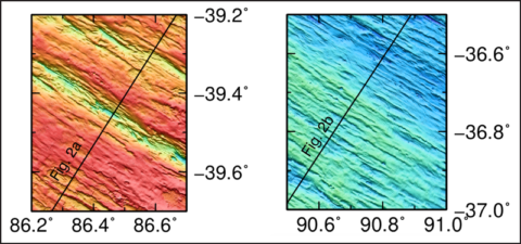
The scans for MH370 revealed that the ocean crust rises and falls in waves that start at the Southeast Indian Ridge and continue outward. The ridge spreads about 35 millimeters in opposite directions every year, and the wave crests, where crust grew faster, are more than 100 kilometers long and repeat every 10–14 kilometers.
The researchers estimated when each wave formed by comparing the bathymetry maps to independent measurements and models of the crust’s magnetic field.
The ocean crust is like “a magnetic tape recorder,” said lead author Ross Parnell-Turner, a marine geophysicist at Scripps Institution of Oceanography in La Jolla, Calif. Crustal rocks record the polarity of Earth’s magnetic field as they form, allowing scientists to trace the age of different sections of ocean crust.

“You might expect that oceanic crust is formed in this constant process, so you might have a uniform thickness, for example, of oceanic crust being formed,” he said. “What we found, actually, is that the pace at which new crust is formed varies on this…characteristic timescale of 300,000–400,000 years.” The wavy pattern repeated for 12 million years.
It’s not so strange that ocean crust topography has some periodicity, Sim explained. It would be much odder for the crust to form perfectly flat for millions of years on end.
What is odd about these waves, however, is that the characteristic timescale doesn’t match up with glacial cycles that are governed by changes in Earth’s orbit around the Sun and its axis of rotation. So-called Milankovitch cycles regulate ice coverage and sea level on timescales of 23,000, 41,000, and 100,000 years.
It’s been fiercely debated in recent years, Parnell-Turner explained, whether the waxing and waning of sea level modulate how quickly new crust forms at seafloor ridges. Data from oceanic crust not far from the MH370 search site support this theory.
But for the Southeast Indian Ridge, at least, that appears to not be the case. “We have a very long record of crustal accretion over a very large area,” Parnell-Turner said. “We did not find any evidence for cycles of crustal accretion on those Milankovitch timescales.”
Melted Mantle Through Thick and Thin
Seeking an alternate explanation, the researchers tested whether the periodicity could be caused by variations in how melted the magma is when it comes up through the seafloor. Using simplified computer simulations, the team found that the phenomenon, called porosity waves, created variations in ocean crust topography at timescales similar to those seen in the bathymetry.
“As the mantle upwells, it starts to melt due to decompression melting” and becomes a fluid-like magma, Sim explained. “What you see are melt-rich pockets forming in waves and moving toward the ridge axis where the oceanic crust is created.”
“The authors of this paper make a convincing case for a longer-scale structure…and plausibly attribute such features to mantle processes,” said John A. Goff, a senior research scientist in seafloor mapping at the University of Texas at Austin. “What really makes that possible is the exceptionally long record in terms of crustal ages from the MH370 search.” Goff was not involved with this research.
This bathymetry map, although a significant leap forward in resolution, can’t tell the team for sure whether porosity waves, glacial cycles, or something else like mantle composition is truly behind ocean crust waves. The fact is, it’s just one location where the seafloor is spreading.
“We don’t have very good data in a lot of the deep ocean,” Parnell-Turner said. “Collecting more bathymetry data like this in areas where we have the crust exposed would be helpful” in figuring out the extent to which each process might regulate crust formation.
“These kinds of studies drive home the point that exploration-driven science is as valuable as hypothesis-driven science,” Goff said.
—Kimberly M. S. Cartier (@AstroKimCartier), Staff Writer


